- Capabilities
- Getting started
- Architecture center
- Platform updates
Polygon and line displays
Maps can render polygons and lines based on your ontology objects. There are two ways to specify the line or polygon geometry to draw:
- Geoshape properties: Display GeoJSON line and polygon geometries stored in a geoshape property on your objects.
- Line segment: Display lines between two geopoint properties on objects.
See value-based styling for more information on how styling rules are configured, as well as color and opacity styling configuration. Polygons and lines can be styled with the following additional attributes.
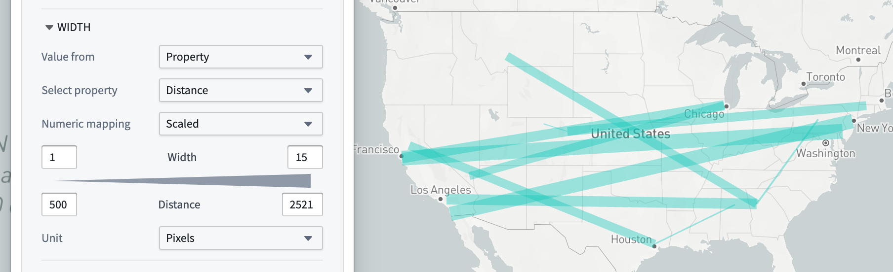
Stroke width
Use the Stroke width section to control the width used when rendering lines, or the stroke of polygons that are not filled.
Stroke style
Use the Stroke style section to control the dash pattern used when rendering lines, or the stroke of polygons that are not filled. The available options are:
| Solid | Dashed | Dotted |
|---|---|---|
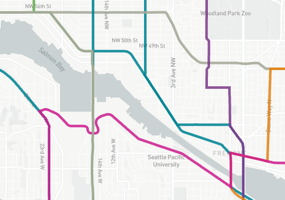 | 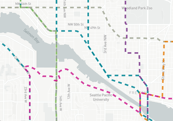 | 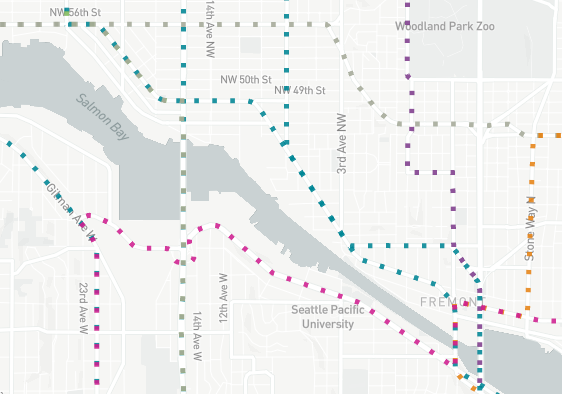 |
For line segments, you can also configure arrows to indicate the direction of the line.

Fill polygons
When Fill polygons is enabled, polygons render with a minimal stroke and their interior filled with the specified color. When disabled, the polygon is instead only stroked, using the styling configuration in Stroke width and Stroke style.
| Fill enabled | Fill disabled |
|---|---|
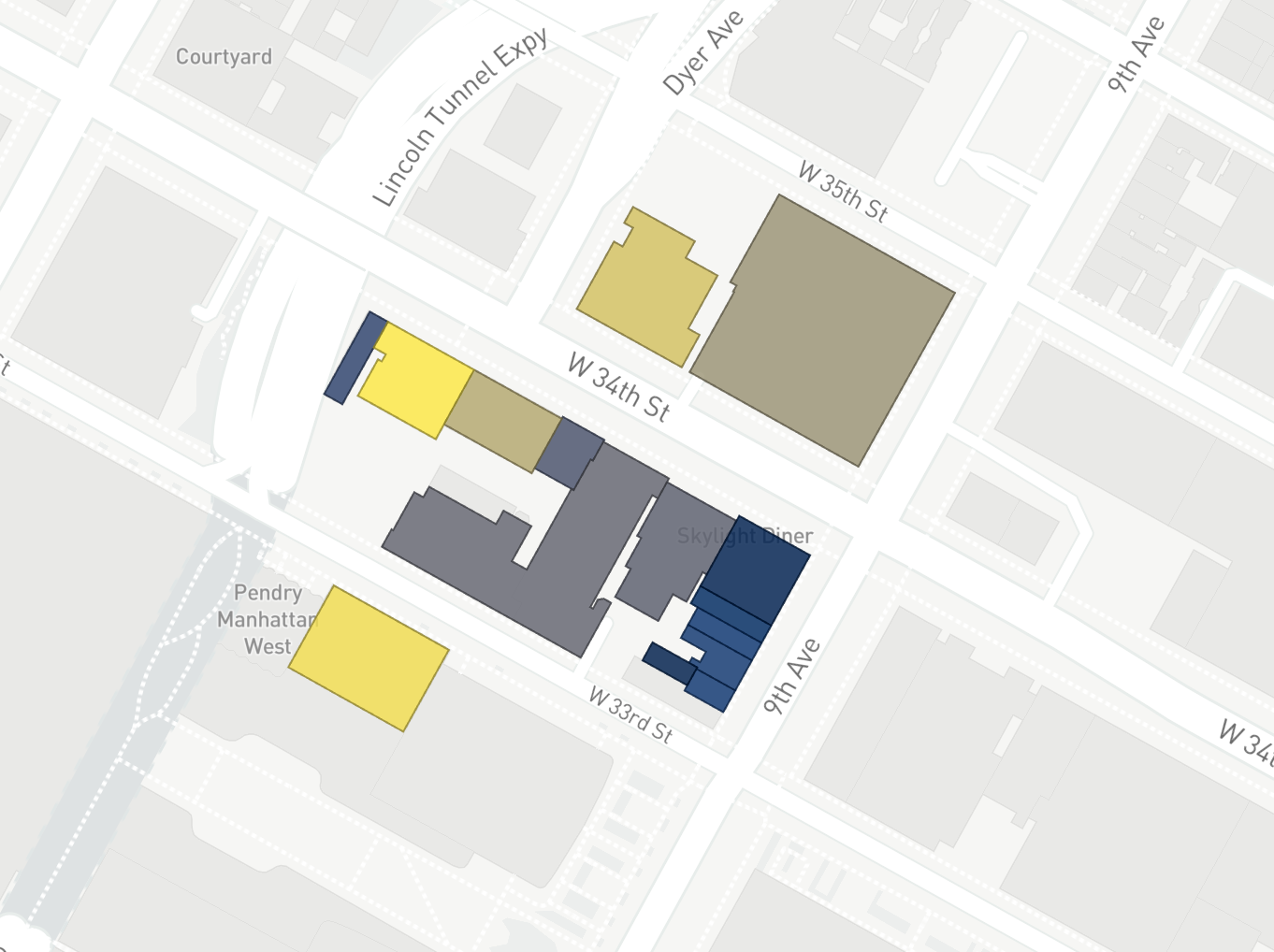 | 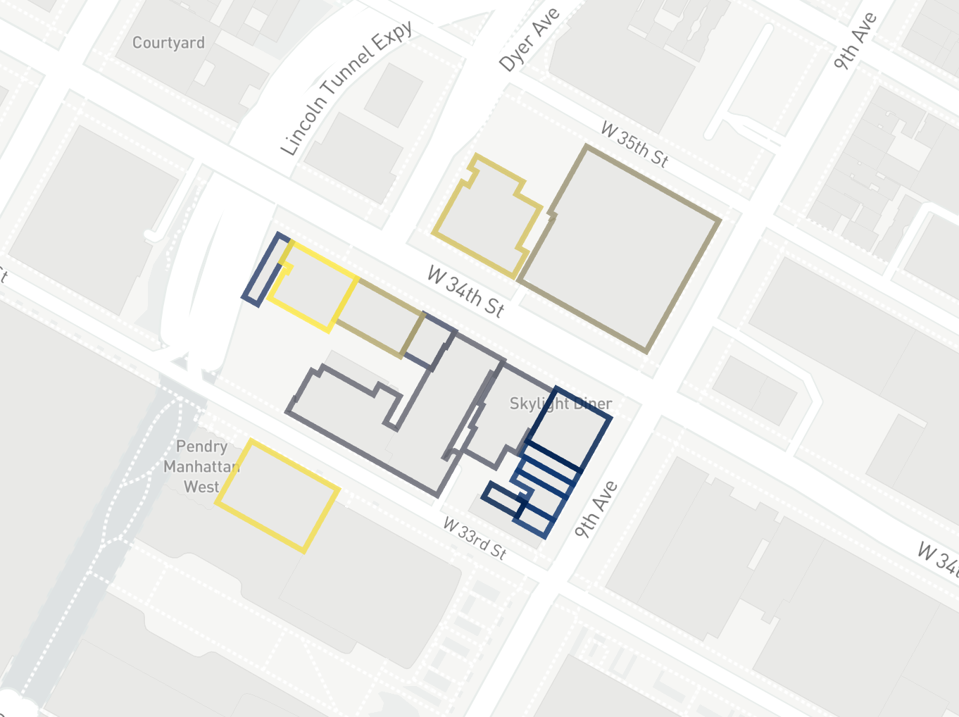 |
Loading methods
When displaying a large number of objects, polygon and line geometries can also support tile-based loading methods.