- Capabilities
- Getting started
- Architecture center
- Platform updates
Loading methods
By default, the Map application loads all objects in a layer to render them on the map. This inherently creates a scale limitation, as you can only render as much data as you can load from the Ontology into your browser. The Loading method configuration facilitates the presentation of high-scale object sets by restricting the application to load only the necessary data required to display the visible extent of the map.
Configure loading methods
You can configure loading methods for a display with the Loading method dropdown menu in the style panel.
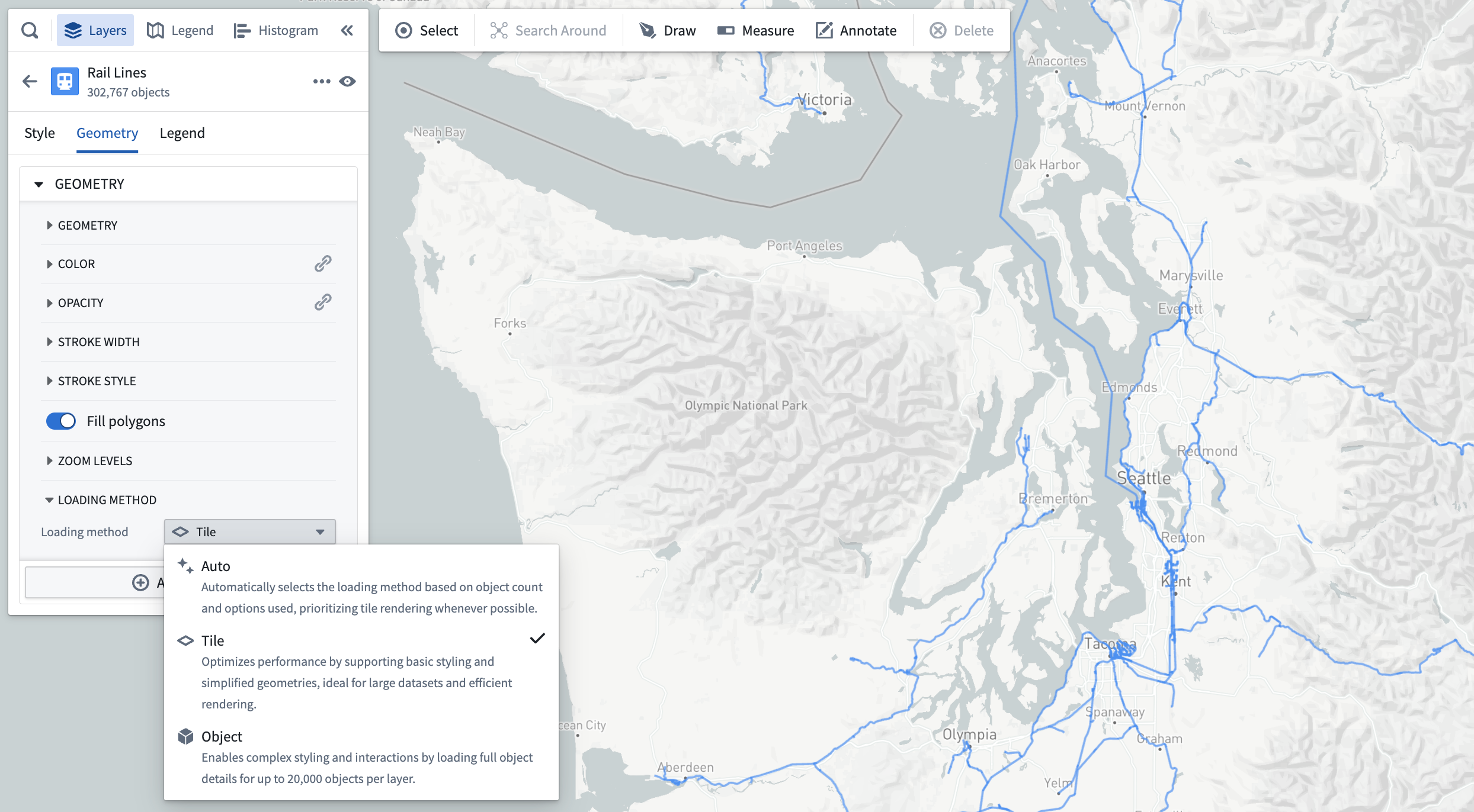
The loading method options are as follows:
- Auto: By default, the application will use the contents of the layer to infer the optimal choice between tile-based and object-based loading.
- Tile: Loads simplified geometry data within the bounds of the map viewport. This option is best suited for large object sets and prioritizing performance.
- Object: Loads full details for individual objects. This option is best suited for complex styling settings.
You will only be able to select a loading method selection for a display if the following is true:
- The object type for the layer has at least one geopoint or geoshape property.
- The geometry property has the Searchable render hint enabled in Ontology Manager. If Searchable is not enabled, tiles will be empty and no objects will be visible on the map.
- Tile-based rendering is supported for the display type. Only icon, circle, and geoshape-based displays are currently supported.
Add objects with tile-based loading methods
For object types that support tile-based loading methods, the search dialog will not limit how many objects can be added to the map. As such, the Add all option will always be enabled.
Tile-based loading method compatibility
Objects rendered in a tile-backed display do not work correctly with a number of other Map application features. Many incompatible features require loading data from services that cannot support the scale of data rendered in tile-based layers.
The following sections list the Map capabilities that are not compatible with tile-based loading methods.
Styling
Geopoint and geoshape properties are the only geometry sources supported for object layer displays, and only property values are supported for all value-based styling options.
As such, the following options are not supported:
- Time series-based styling (measures and TSPs)
- Functions
- Opacity by time
- Labels
- Timeline geometries
Filtering
Objects displayed in a tile-based display do not respect filtering applied in the histogram or the timeline.
Shapes
Objects displayed in a tile-based display will not be included when creating shapes from the active selection.