- Capabilities
- Getting started
- Architecture center
- Platform updates
Map interface overview
This page describes the elements of the Map application interface, shown below:
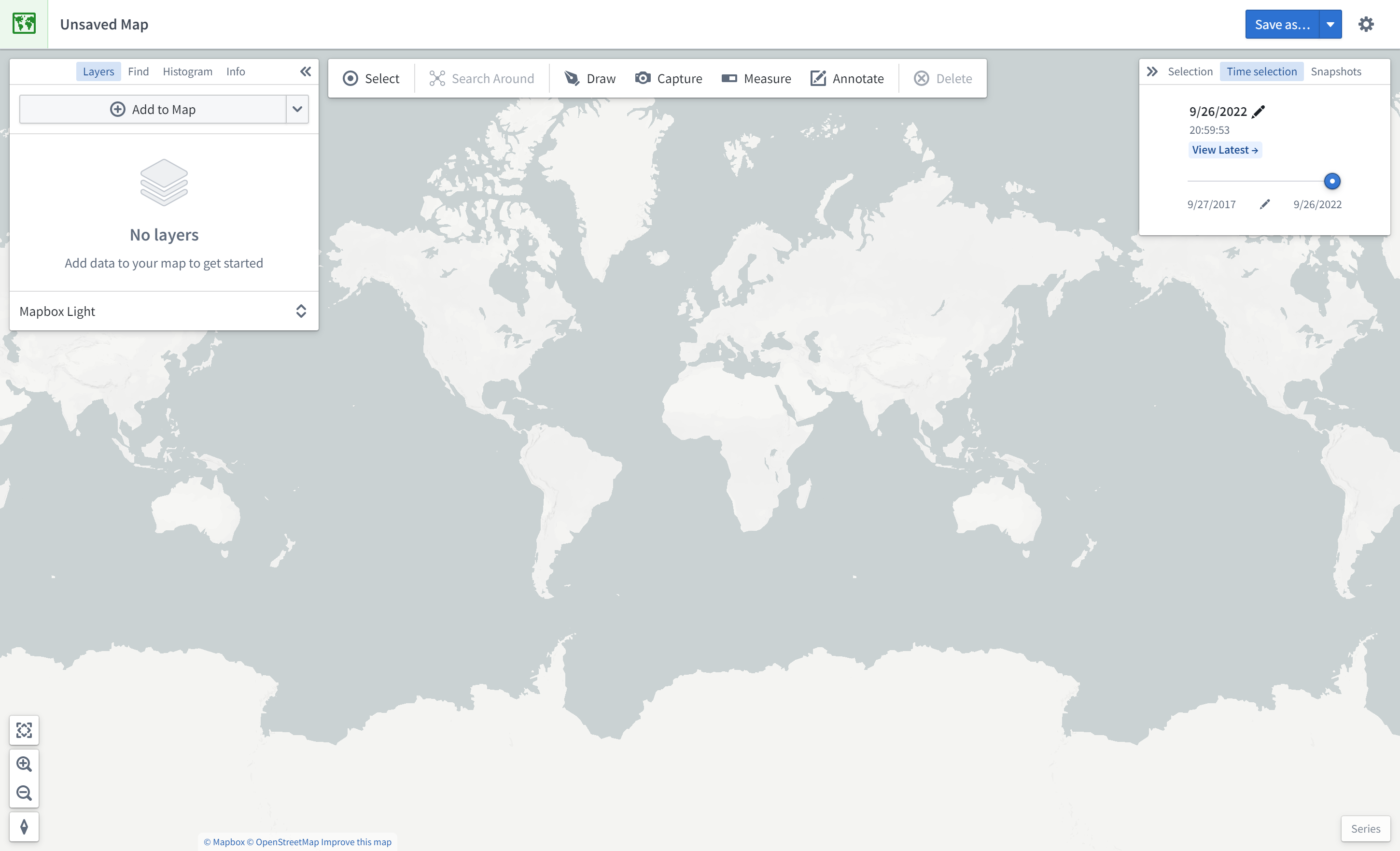
Panels
The left side of the interface contains the following panels:
- Layers: Add, manage, and style object and overlay layers; set the base layer.
- Find: Find objects and locations; navigate to specific geospatial coordinates.
- Histogram: Analyze and filter objects based on property and time series values.
- Info: Display an overall summary of the map.
The right side of the interface contains the following panels:
- Selection: Analyze details about and take actions on the selected items.
- Time Selection: Set the time range and current timestamp to apply to the map and time series views.
At the bottom right of the interface, the Series panel enables temporal analysis of time series and event data.
Toolbars
At the top of the interface is a toolbar with the following functionality:
- Select: Select all items on the map, invert selection, or select items intersecting with a drawn shape.
- Search Around: Explore object relations.
- Draw: Draw and interact with shapes on the map, including polygons, circles, rectangles, lines, points.
- Capture: Capture a screenshot of the current map state.
- Measure: Measure physical distances on the map.
- Annotate: Add text or polygon annotations to the map.
- Delete: Remove items from the map.