19 - Map Annotations: Shapes, Part 1
This content is also available at learn.palantir.com ↗ and is presented here for accessibility purposes.
📖 Task Introduction
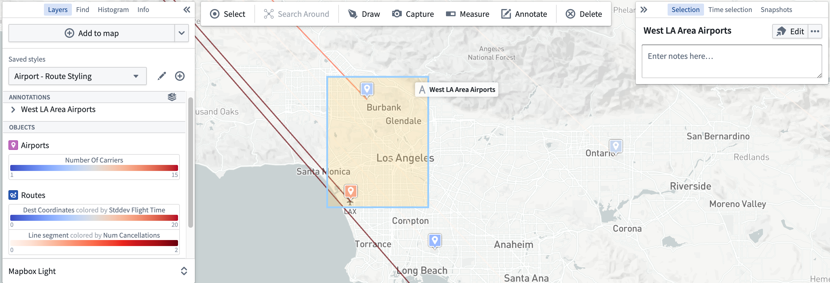
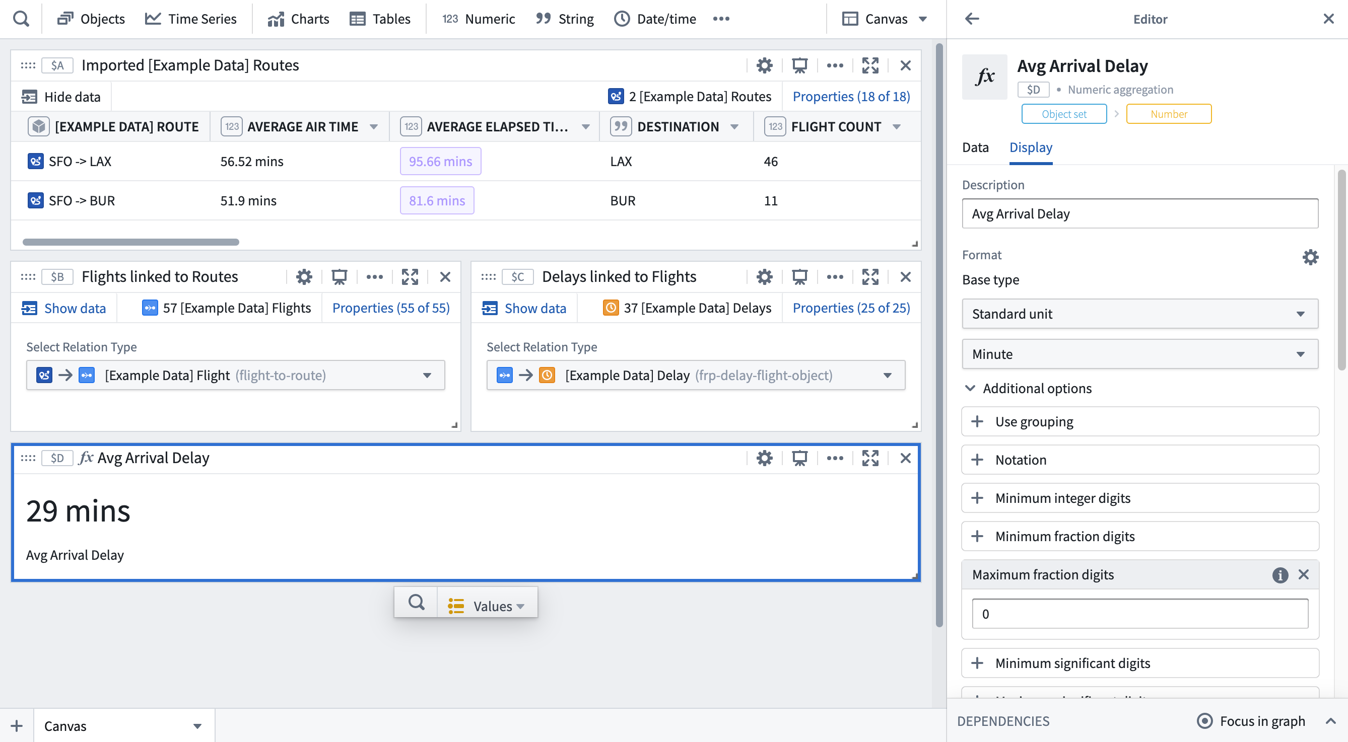
Zooming in on the San Francisco area, your link coloring signals a relatively high number of cancellations on the routes from SFO airport (SFO) to the West Los Angeles area (BUR and LAX). Let's assume we brought the SFO -> LAX and SFO -> BUR objects into Quiver for further analysis and determined the average arrival delay time was 29 minutes.
The image below is a sketch of how that analysis flow might occur.
-
Routes selection in Map

-
Analysis in Quiver
To learn more about object analysis in Quiver, you can follow the Introduction to Quiver course.
In this task, you'll use map annotations to indicate this potentially relevant data point.
🔨 Task Instructions
- Click Annotate () in the top toolbar and choose to draw a Rectangle.
- Draw the shape around the Los Angeles West area (LAX and BUR airports) as shown in the image below.
- In the Selection panel in the upper right, change the default annotation name from
New annotationtoWest LA Area Airports. - Likewise change the annotation layer name in the Layers panel.