13 - Practice Solution
This content is also available at learn.palantir.com ↗ and is presented here for accessibility purposes.
Visualize all flights landing within 100 miles of San Francisco that were delayed due to carrier.
Answers
- How many flights appear on your completed map? 59
- Which origin airport lies farthest to the East? BOS
- Which flight origin occurs the most frequently in the final mapped data? SNA & DEN, identified in the histogram panel
Solution Walkthrough
-
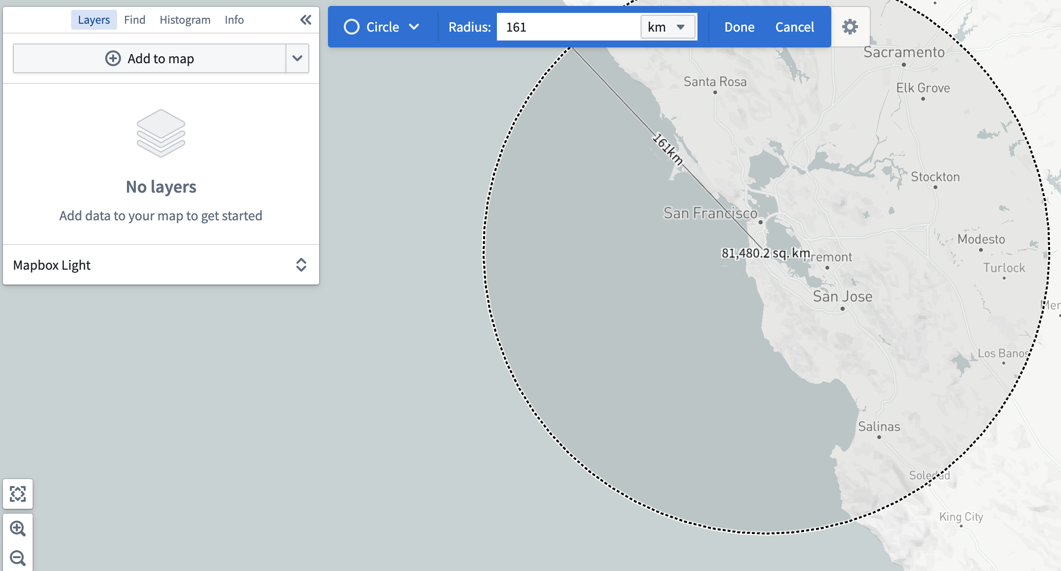
Use the coordinates to find (or manually locate) San Francisco, California, USA and perform a Search for objects that intersect a shape.... Draw a circle with a 100 mile (161 km) radius.
-
In your radius, search for
[Example Data] Delayobjects with a filter on the Carrier Delay property, setting the minimum value to 1 (i.e., weather delays of at least 1 minute). This should return 59 delay objects.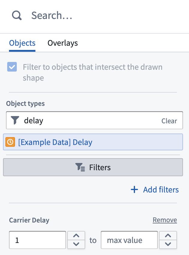
-
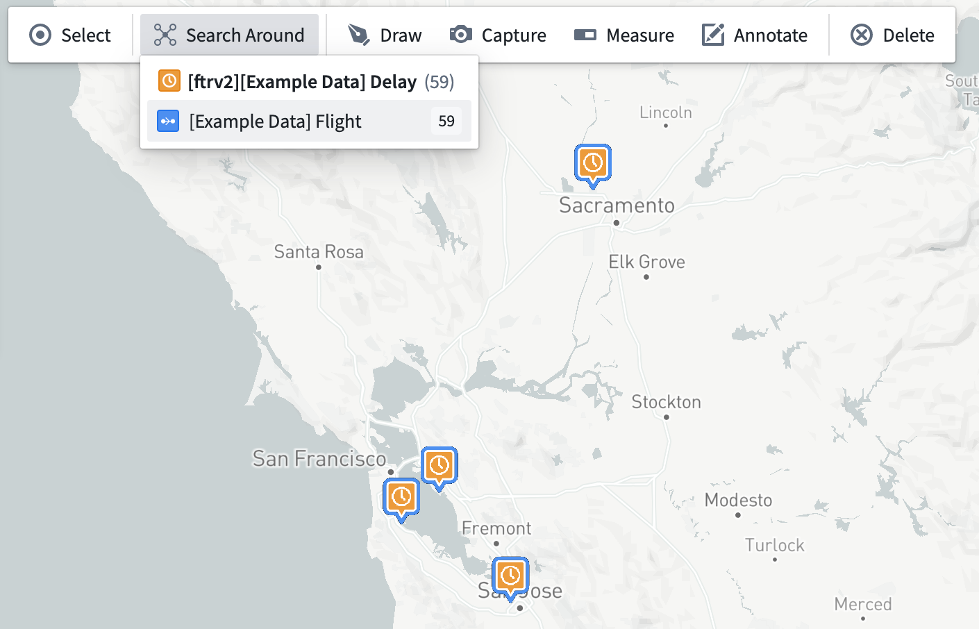
As shown in the exercise prompt, delay objects are not linked to airports, but flights are. With your newly added delay objects on the map, perform a Search Around and bring back all linked flights.
-
Select all objects in the
[Example Data] Flightlayer, and Search Around for origin airports. There should be 31 origin airports.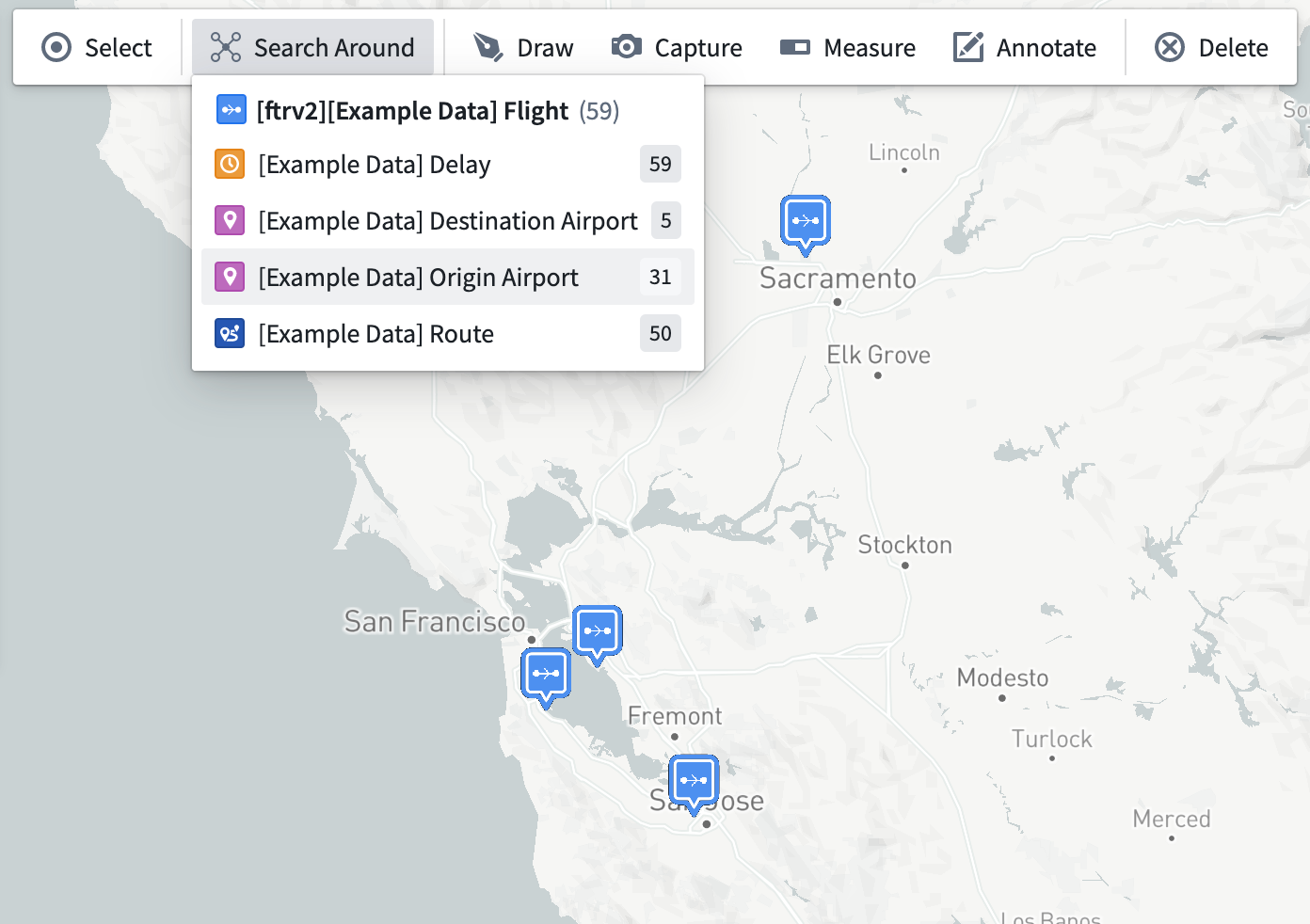
-
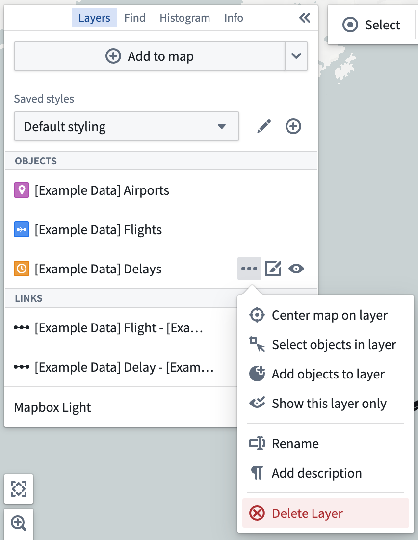
The
[Example Data] Delaylayer has served its purpose and can be removed from the map if desired.