12 - Practice Geospatial and link-based search
This content is also available at learn.palantir.com ↗ and is presented here for accessibility purposes.
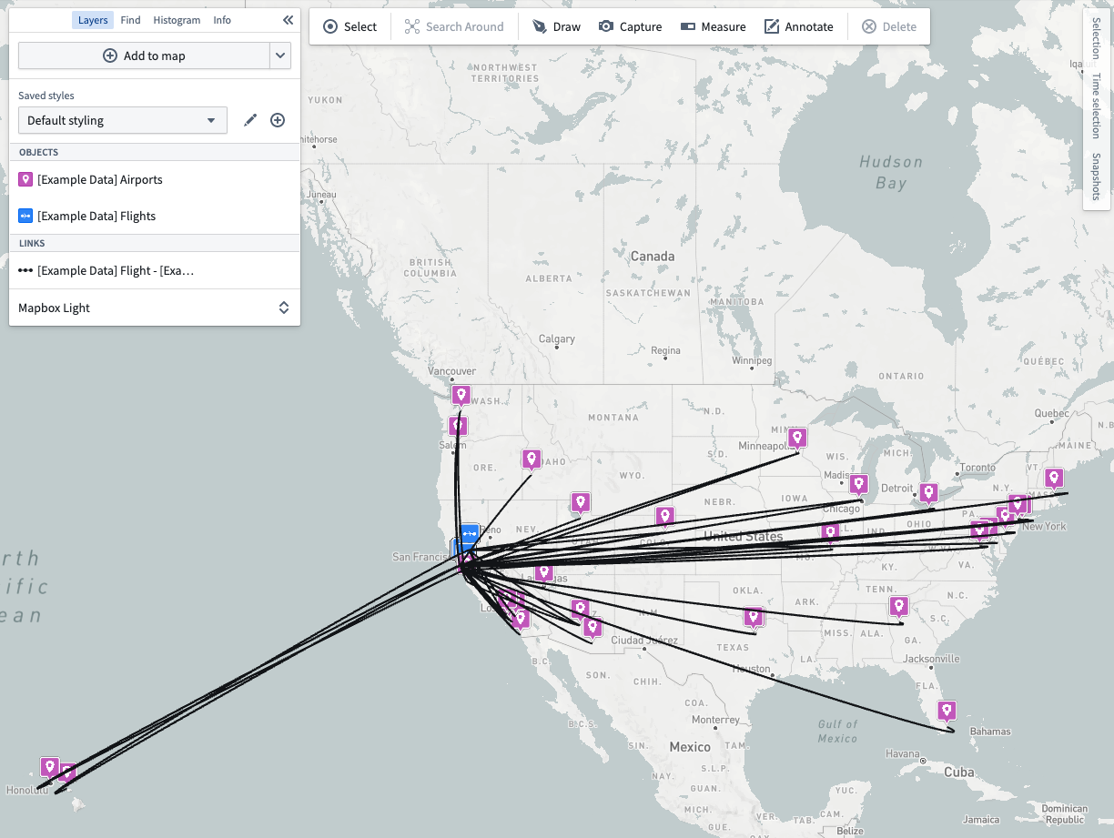
Visualize all flights landing within 100 miles (161 km) of San Fransisco (37.62, -122.38) that were delayed due to carrier.
Your end product might look something like this image:
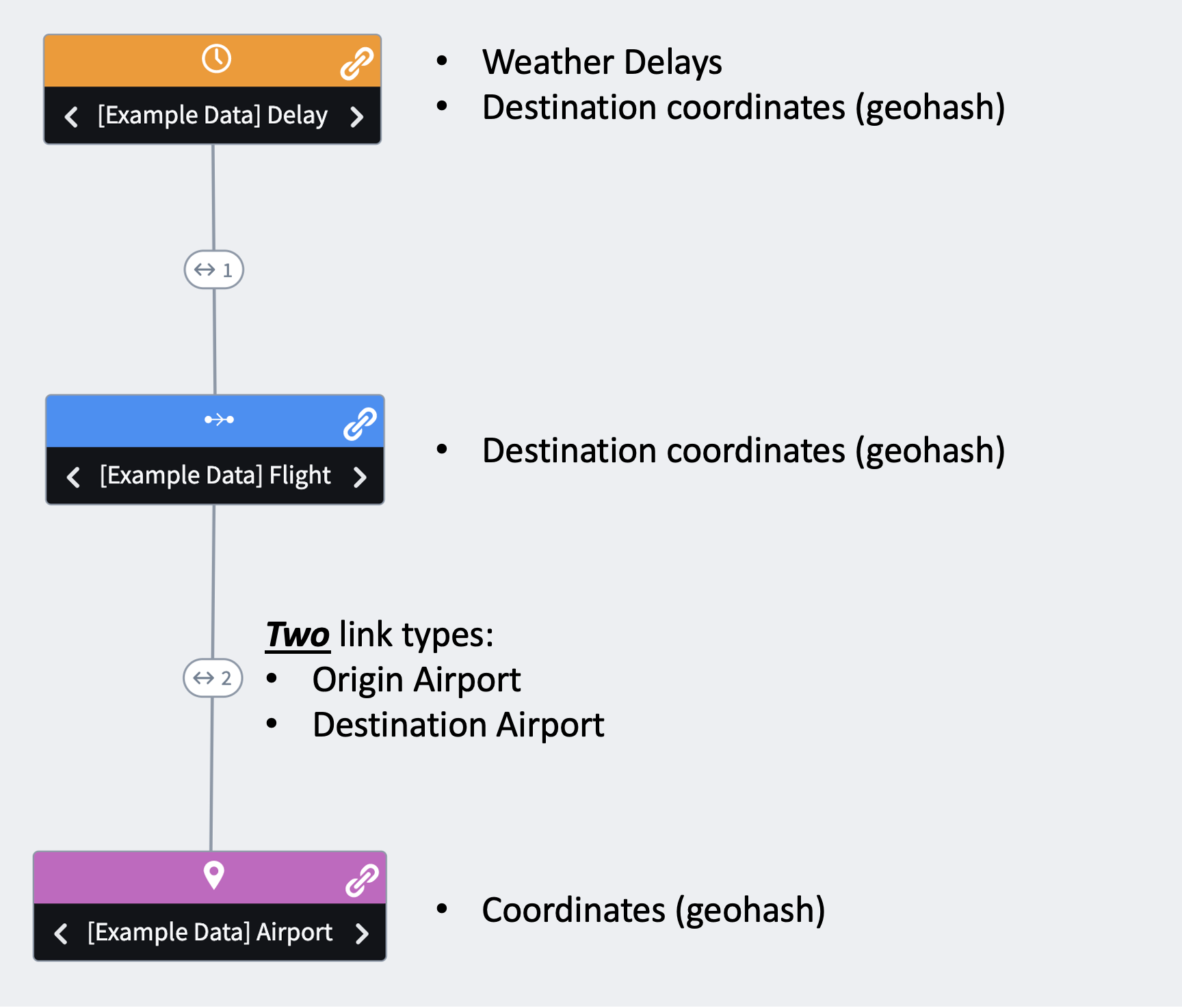
This practice exercise will require you to traverse links between delays, flights, and airports, so it's critical to understand the supporting Ontology:
Here are some additional prompts to help you as you work:
- You can select all objects in a layer by clicking the
...next to the layer name in the Layers panel. - A Carrier Delay has occurred when the value of
Carrier Delay(on the[Example Data] Delayobject type) ≥1.
Questions
- How many flights appear on your completed map?
- Which origin airport lies farthest to the East?
- Which flight origin occurs the most frequently in the final mapped data?
The next task contains the answers and illustrated solution walkthrough.