3 - Add Object Sets to the Map
This content is also available at learn.palantir.com ↗ and is presented here for accessibility purposes.
📖 Task Introduction
The Foundry map can display (1) object sets with geospatial properties and (2) map overlays. Recall these relevant definitions:
- Object Type: the schema definition of a real-world entity or event, e.g.,
Flights. - Object: a single instance of an Object Type. For example,
NK469 DFW->LAS 2018-05-23is an object of the typeFlight. - Object Set: a collection of multiple objects. For example, "all flights from Stockholm on January 31, 2023."
In the next three tasks, you’ll practice various ways of searching for and visualizing object sets on the map.
🔨 Task Instructions
-
In the Layers panel, click the ⊕ Add to map button.
-
Type
[Example Data] Airportinto the object types search field. -
Choose
[Example Data] Airportfrom the list of the returned results below the search bar. *Hint: there should be 353 results.The right side of the dialog window now shows all individual objects of this type that could be added to the map. Let’s start by adding all of them.
-
Click the Add all (353) button in the bottom right.
Practice zooming in and out, dragging the map, and clicking on individual airport objects (which displays the selected object's properties in the Selection panel on the right side of the screen).
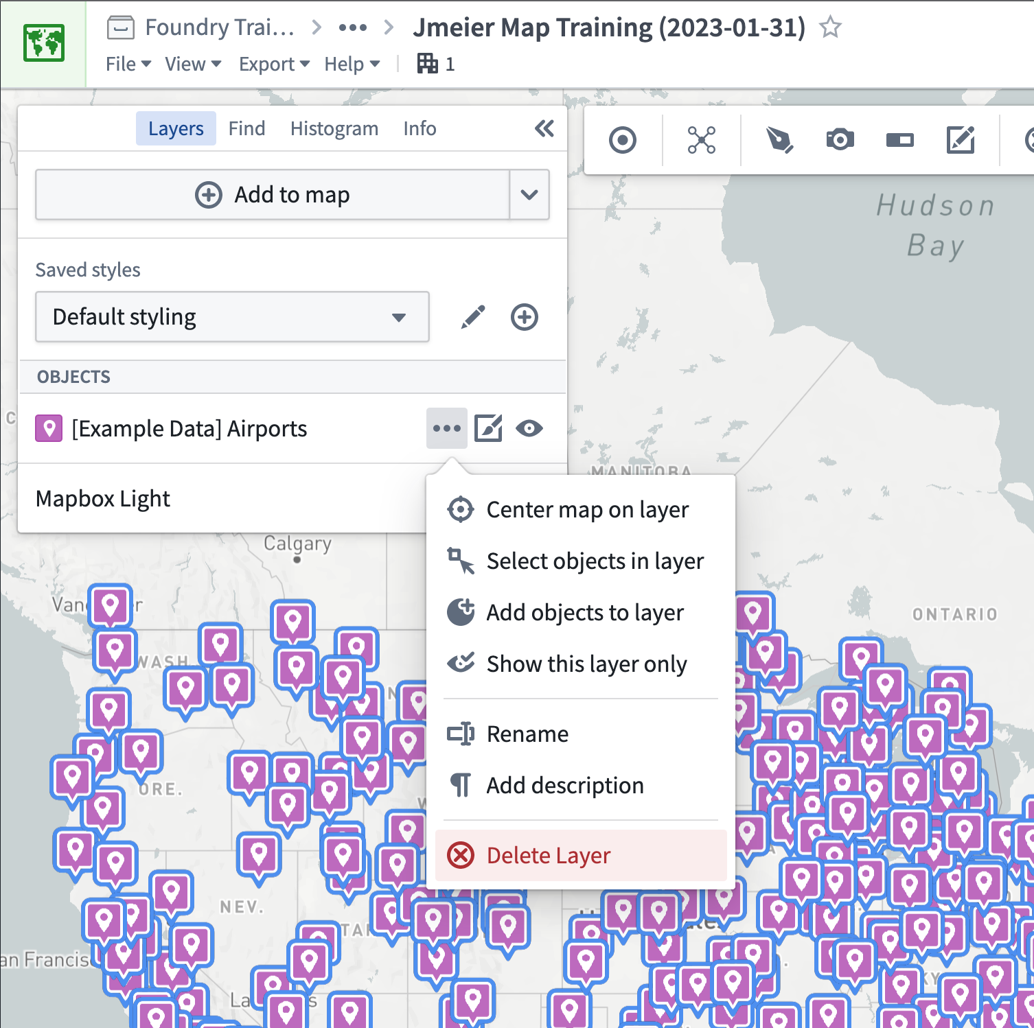
The objects on the map represent a layer configurable in the Layers panel in the upper left.
-
Remove the airport objects layer by mousing over the
[Example Data] Airportitem in the object layers list, clicking the..., and choosing ⓧ Delete Layer as shown below.